Hike at Varina LandLab
Register
Date and Time:
Sun, May 18, 2025; 9:30 AM
(Eastern)
Add to Calendar
05/18/2025 9:30 AM
America/New_York
Hike at Varina LandLab
A 3-4 mile hike through the Varina LandLab conservation area
9101 Deep Bottom Rd, Richmond, VA 23231, USA
Webinar URL:
37.41329000,-77.31199600
Ralph Grove
rfgrove@icloud.com
MM/DD/yyyy
amOUuwqNAzpGSXwtHmnd12740
Organized By: Falls Of The James Group
Location: 9101 Deep Bottom Rd, Richmond, VA 23231, USA
Map | Directions
Event Organizers:
Ralph Grove
rfgrove@icloud.com
(540) 478-3677
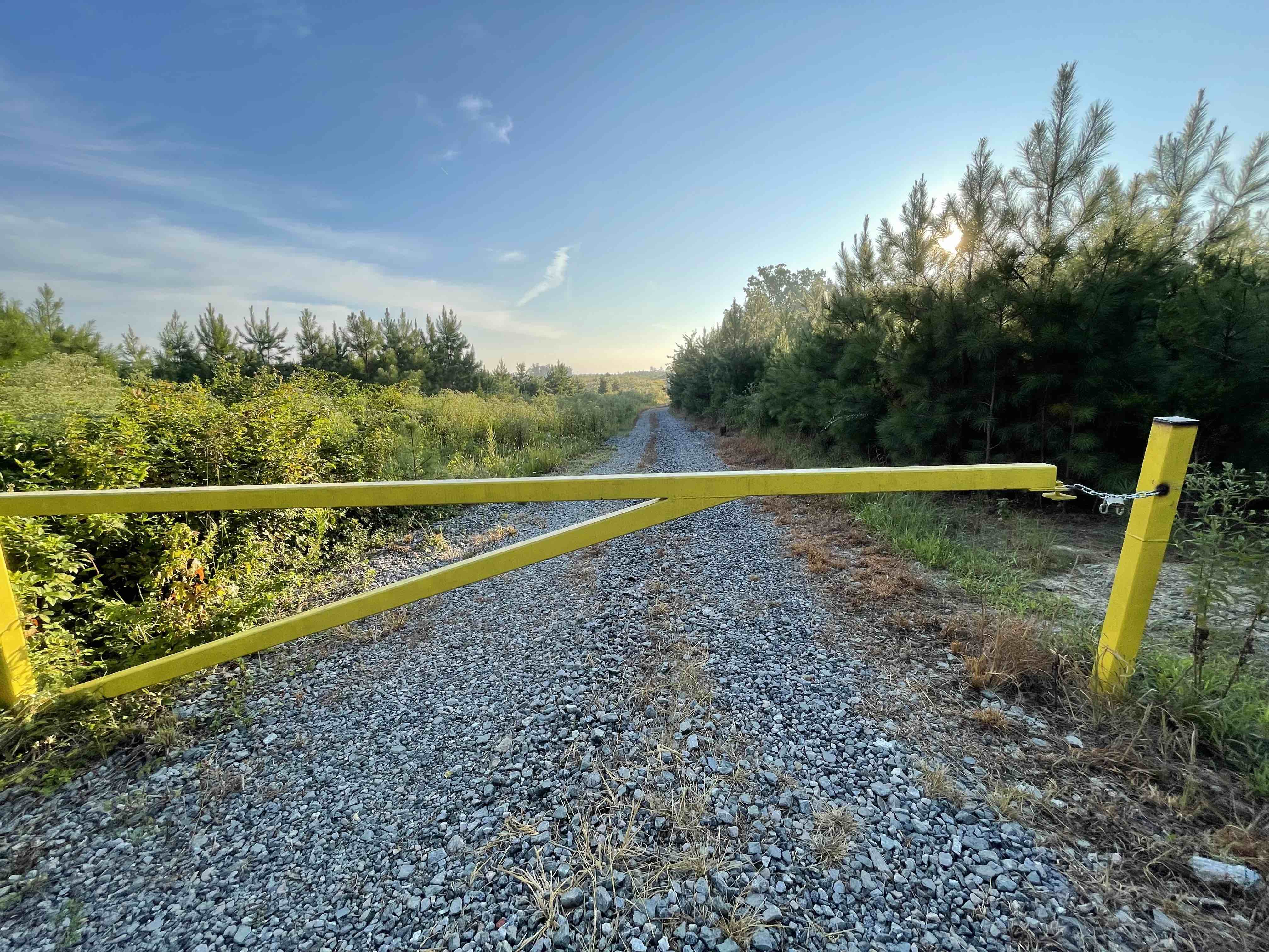
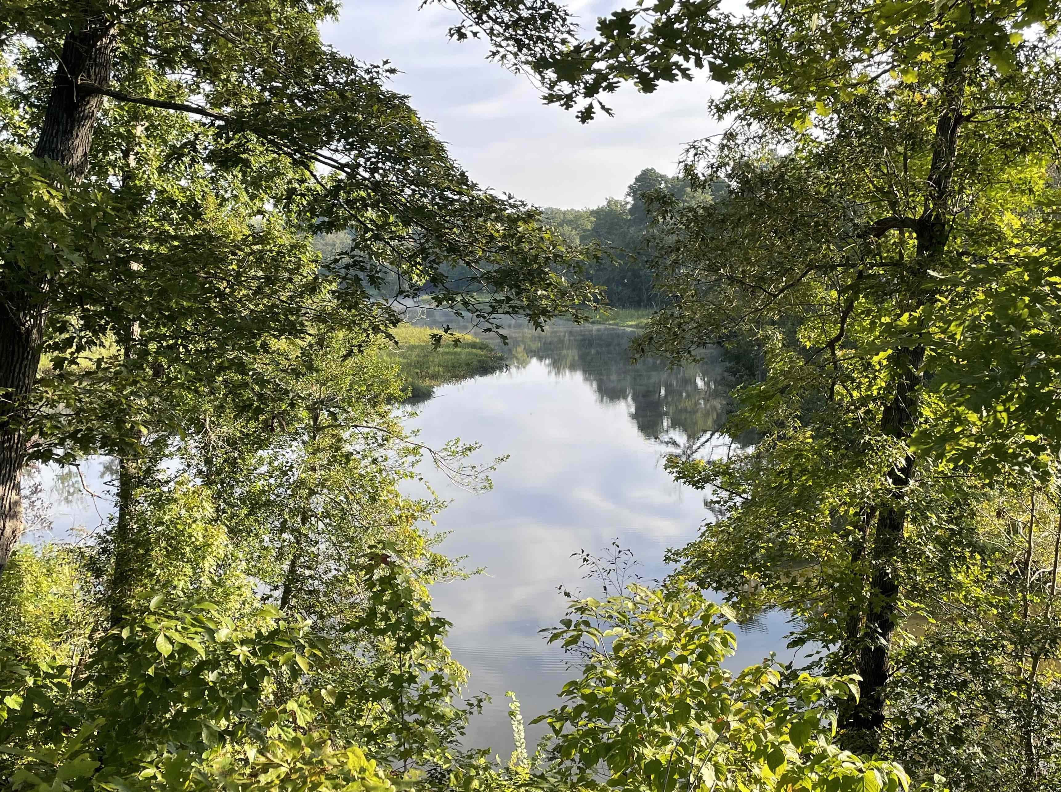
The Varina LandLab is located in eastern Henrico County adjacent to Deep Bottom Park and fronts the James River, Four Mile Creek, and Roundabout Creek. It is dubbed a “LandLab” for its purpose as an outdoor classroom for local K-12 students, University classes, and curious minds of all ages. The biodiversity that can be found at Varina LandLab is extraordinary and offers an opportunity to learn about ecology, sustainability, and effective land management.
On this hike, we'll walk 3-4 miles of the trails through the LandLab, some over open ground and some through woods. The trails are a combination of gravel roads and grass. Grass trails may be wet, so wear shoes that you don't mind getting wet and bring a pair of dry socks for the trip home.
Level: Easy
Cost: Free
Bring: Water, sun protection, jacket, binoculars
Signup Restrictions: All participants must sign a Sierra Club waiver to participate. Pets are allowed on this outing. Anyone under 18 must be accompanied by a parent or guardian.
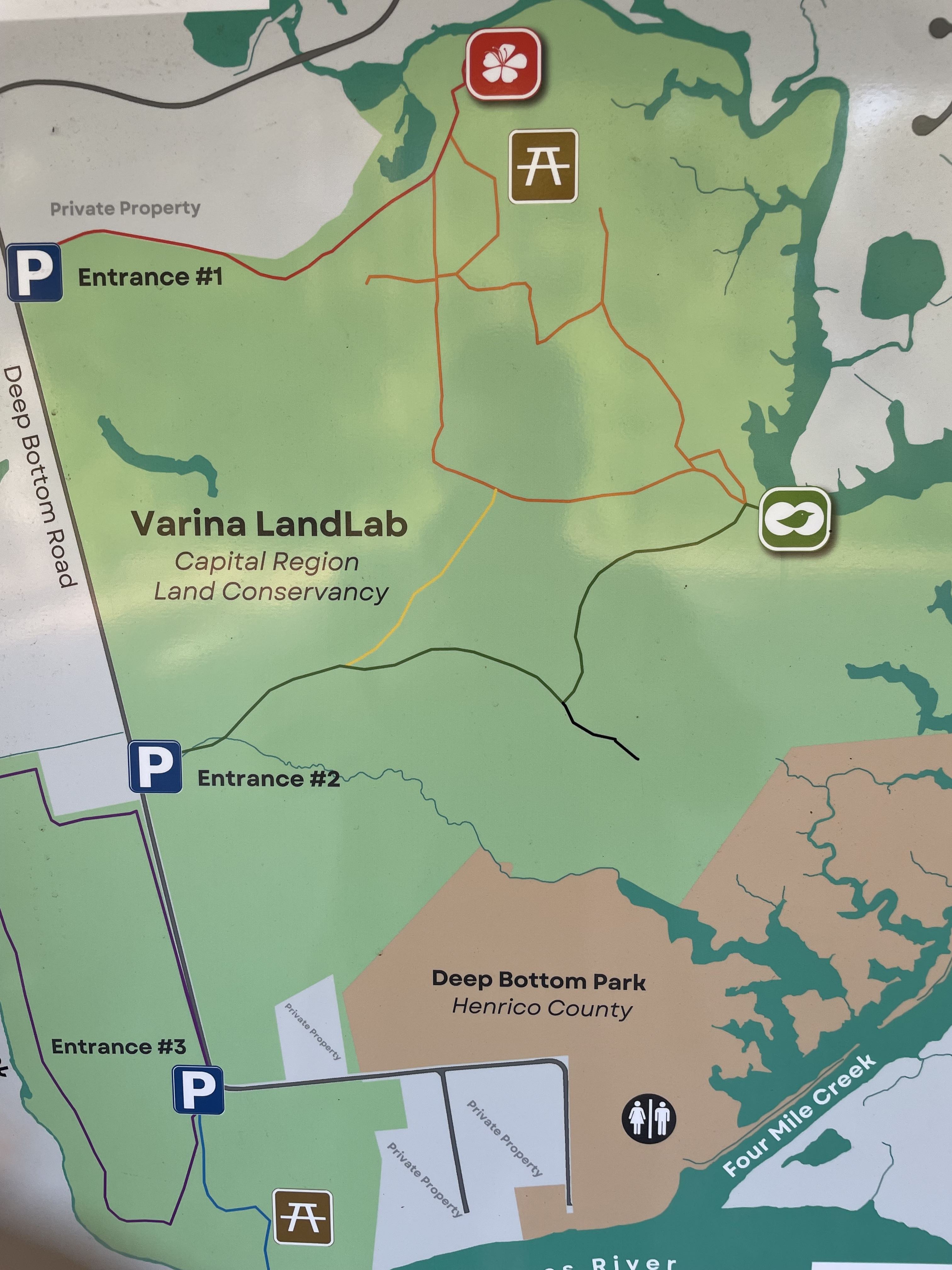
Additional Directions: Meet at Entrance #2, on Deep Bottom Road. After turning onto Deep Bottom Road, you'll pass Entrance #1 on the left almost immediately. Entrance #2 is on the left about 1/3 mile further down the road. Google Maps will show you only Entrance #3, which is further down the road on the right. See the park map at https://capitalregionland.org/wp-content/uploads/2023/05/VLL_Map_wClosure_May31_2023.pdf
Cancellation Policy: Any rain cancels
More info