Byron Glacier
Date and Time:
Fri, Jul 18, 2025; 6:00 PM
- 7:00 PM
(Alaska)
Add to Calendar
07/18/2025 6:00 PM
07/18/2025 7:00 PM
America/Anchorage
Byron Glacier
Evening hike out to Bryon Glacier
1500 Byron Glacier Rd, Girdwood, AK 99587, USA
Webinar URL:
60.77156300,-148.82974400
Andrew Roy
andrewcroy@gmail.com
MM/DD/yyyy
amOUuwqNAzpGSXwtHmnd12740
Organized By: Alaska Chapter
Location: 1500 Byron Glacier Rd, Girdwood, AK 99587, USA
Map | Directions
Event Organizers:
Andrew Roy
andrewcroy@gmail.com
(512) 521-6389
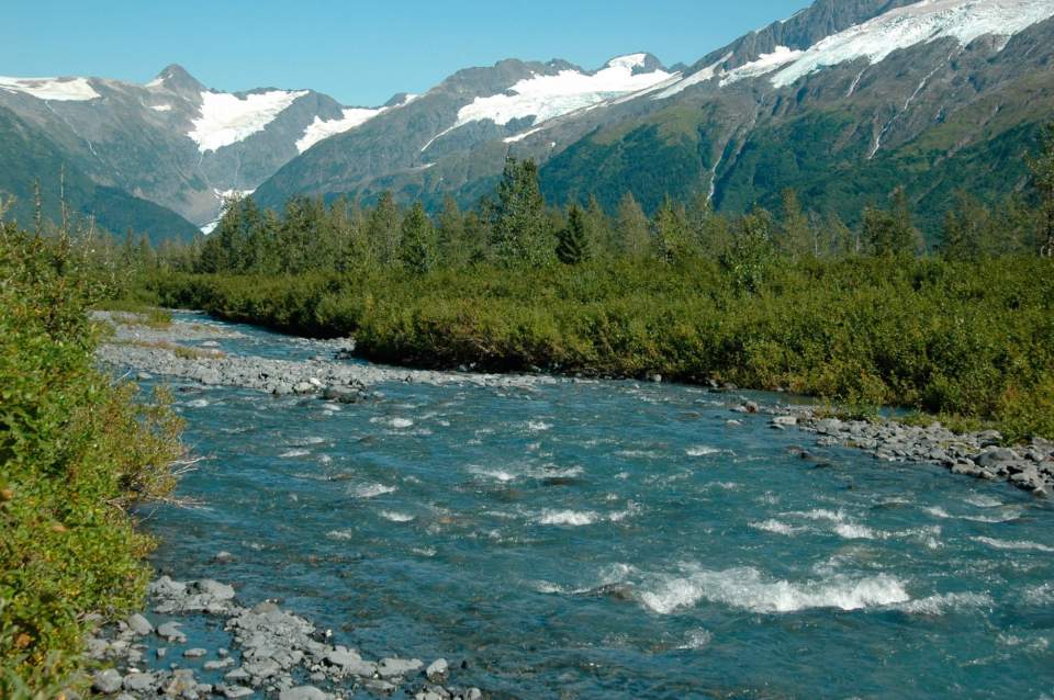
This short day hike—with an easily accessible trailhead a few hundred meters from the Begich Boggs Visitor Center—offers you big views of the Byron Glacier. The glacier itself lies just beyond the end of a flat, well-maintained trail up a narrow, glacier-scoured valley south of the Portage Lake.
Byron Glacier descends from the same ice field that feeds both Portage Glacier on the lake and Blackstone Glacier in Prince William Sound. The trail is a real-time demonstration of how an ecosystem rebounds from the ice age, with large trees and forest giving way to alder thickets, which in turn morph into lichen-dotted rock only recently exposed by retreating ice. The upper valley is rugged and raw—with silt-blackened debris covering ice—offering an austere feel for authentic glacial terrain, as though you were on an adventure deep in Alaska’s coastal backcountry.
The Trail
The trail starts at a well-marked pullout, about half a mile from the end of the road. When the trees were shorter, you could see the glacier well from the road, but now you have to hike a ways before the ice face comes into view. Follow the winding, mostly flat trail through a rocky, verdant alluvial plain that is now interspersed with tall alders and a smattering of cottonwood and aspen trees. Much of the trail is close to Byron Creek, where kids can play among the smooth stones, but keep an eye because the water is cold and sometimes rapid. As you approach the glacier, the forest thins out to display views of the rugged cliffs and glacier and—if you turn around—Portage Lake and Valley. It’s fun to have an impromptu snowball fight in snowfields left over from winter avalanches, or take one of the multiple side trails that will lead you to the edge of the valley where bouldering opportunities abound.
Two colossal ice cones created by snow avalanches hug the eastern walls of the valley, sometimes showing off dramatic ice caves formed by meltwater streams. Depending upon how much it avalanched during the previous winter, the closest cone might also straddle the creek, which then carves out its own, new cavern. (Do not attempt to enter these ice caves—hunks can fall without warning!) A remnant of Byron lies buried beneath a large rock glacier of boulders and silt, rising above the creek and blocking a view of the upper valley. Byron’s exposed terminus is a quarter mile further up.
Bring: Rain Gear, Sunscreen, Sunglasses, Water and Snacks
Carpool: Can be arranged
Note: Carpool transportation is at the sole risk of the participants.