Boyd Passage 6-8 mile Hike to Cook's Mountain
Register
Date and Time:
Sun, May 17, 2026; 10:00 AM
- 1:30 PM
(Eastern)
Add to Calendar
05/17/2026 10:00 AM
05/17/2026 1:30 PM
America/New_York
Boyd Passage 6-8 mile Hike to Cook's Mountain
Roundtrip 6-8 mile hike to Cook's Mountain (374 ft. elevation) overlooking the Wateree River on the Boyd Passage of the Palmetto Trail.
Goodwill Rd. - Horse trailer parking lot on left across from Duck Pond Rd.
Webinar URL:
33.96095700,-80.64600900
Joan Donohue
joanmdonohue@outlook.com
MM/DD/yyyy
amOUuwqNAzpGSXwtHmnd12740
Organized By: Midlands Group
Location: Goodwill Rd. - Horse trailer parking lot on left across from Duck Pond Rd.
Map | Directions
Event Organizers:
Joan Donohue
joanmdonohue@outlook.com
(803) 361-0039
.
Boyd Passage Hike to Cook's Mountain (6-8 miles)
WHEN: 10am, Sunday, May 17, 2026
WHERE: Wateree River Heritage Preserve, Eastover, SC 29044We will meet at the horse trailer parking lot at the intersection of Goodwill and Duck Pond Roads.Using Google Maps, follow directions to “Goodwill Plantation” and then continue driving for about a half mile.DIRECTIONS: From Sumter Highway (Rt. 378), turn north on Goodwill Rd. at the gate shown in the photo below. Follow Goodwill Rd. for 1 mile, then bear right at the fork and go over a bridge. Continue for 0.4 miles and you will reach Duck Pond Rd. on the right. The horse trailer parking lot is on the left and there is a kiosk.We will hike on Section 2 of the Boyd Passage of the Palmetto Trail to the summit of Cook’s Mountain. At the top, there are great views of the Wateree River and land to the east. Then we will hike a bit further north on the Boyd Passage before returning to the starting point.ADDITIONAL INFORMATION
https://www.palmettotrail.org/trails/trail/boyd-passage
Here is a link to the Komoot route of the planned hikehttps://www.komoot.com/tour/2882527235?share_token=a24TkECgkMJegZipkh9eYhkbiGm3f2Khg8x6hdBikZ8BwcKr0d&ref=wtdOn the pdf map (see link below or photo far below), we will hike from mile 12.5 to 17 and return on a shorter route.
https://files.aptuitivcdn.com/P8Y6wXyOZ7-1806/docs/trails/Updated-Boyd-Section-2.pdfIf you have the Avenza app, you can download the Boyd Passage maps for free.
https://store.avenza.com/search?query=boyd%2520passage&page=0The Boyd Passage of the Palmetto Trail is 23 miles long and traverses between the Wateree Passage to the south and the Fort Jackson Passage to the north. At this point in time, there are no camping opportunities on this Passage. The highlight of the Boyd Passage is the view from Cook's Mountain.
Cook’s Mountain is located within Wateree River Heritage Preserve, which is a 3,674-acre tract of land located 17 miles east of Columbia on U.S. 378 near the Eastover community. The Preserve was purchased by Haile Gold Mine as partial mitigation for a mining operation that was permitted in Lancaster County, SC. It is an important tract of land due to its history and its natural resources.Cook's Mountain rises an elevation of 374 feet above sea level offers scenic views of three counties. The mountain was the home of Mr. James Cook, a famous cartographer, who produced the Cook Map of South Carolina in 1773.The heritage preserve is protecting upland, bottomland and managed wetland habitats and providing recreational opportunities including hiking, hunting and fishing. One important objective is to protect and enhance jurisdictional wetlands and streams on the property by restoring the natural hydrological flow in those areas where the water was historically diverted and by re-establishing bottomland hardwood species on other areas of the property.The Preserve has a wide variety of animal life including white-tailed deer, turkey, bobwhite quail and songbirds. Bird watching, hiking and wildlife observation are encouraged in addition to public hunting and fishing.White milkweed (asclepias variegate) is commonly seen on the property and is readily recognized by its horns and hood flowers (turned inwards). The blossoms (May-July) are a tight umbel of flowers that appear snowball-like.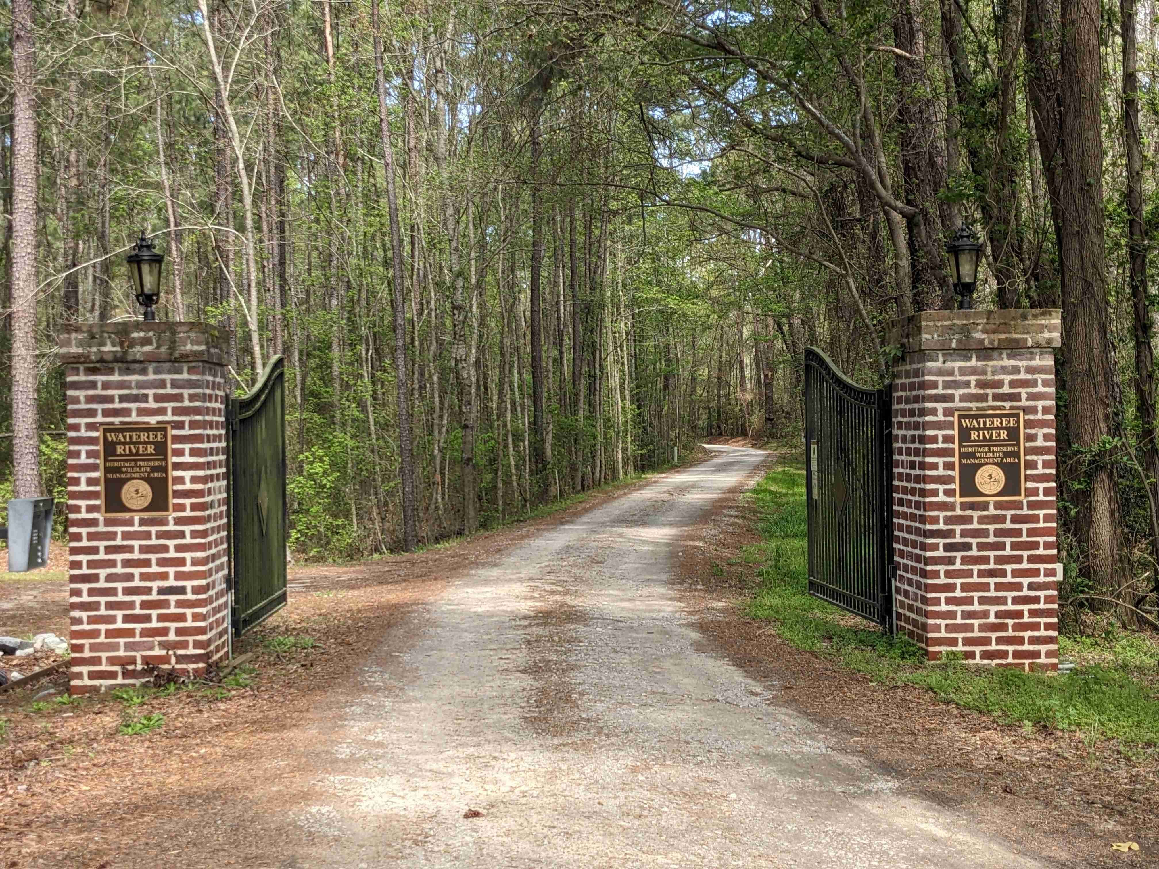
Entrance gate at Sumter Highway and Goodwill Rd.
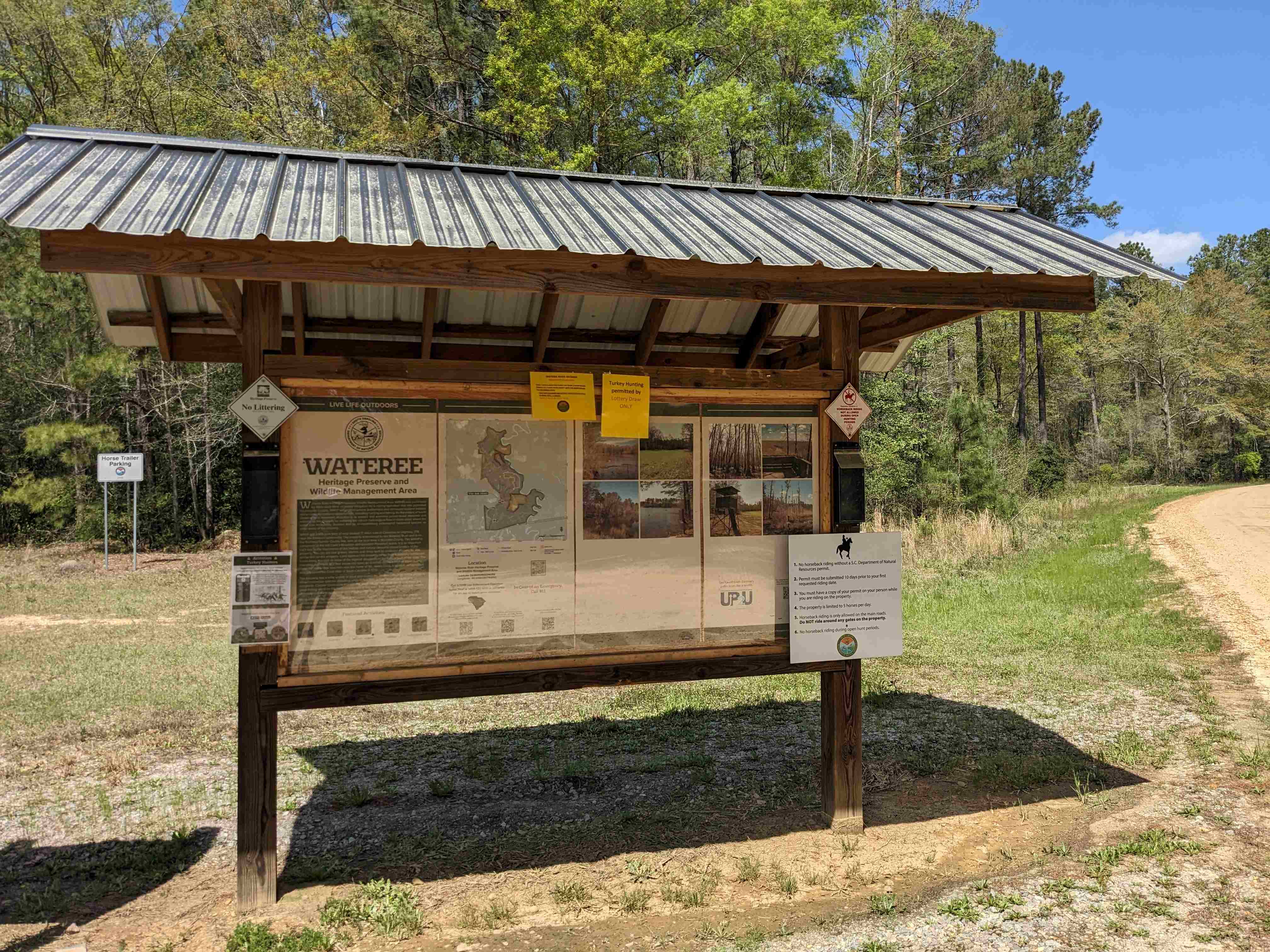
Kiosk at the horse trailer parking lot
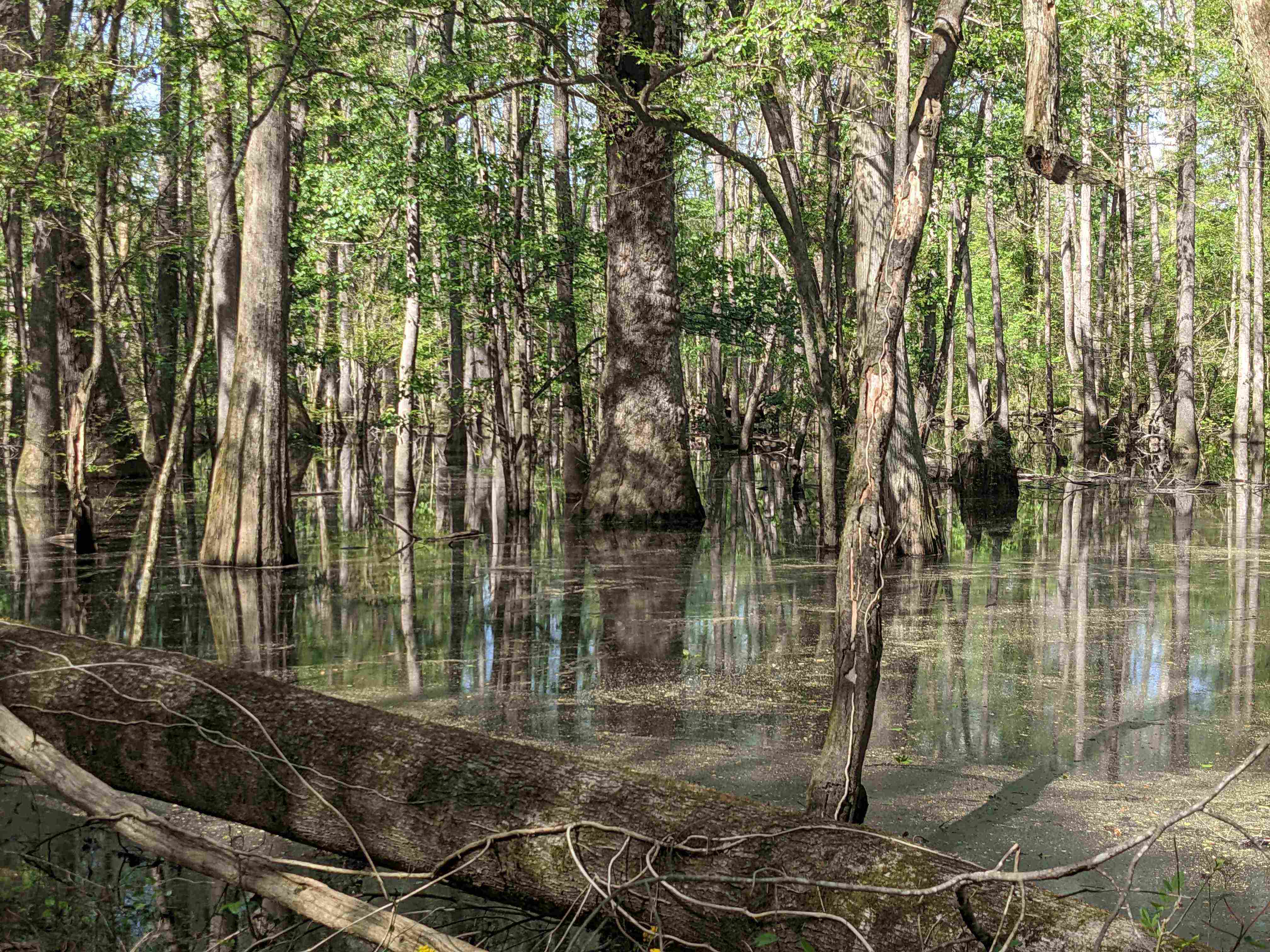
Trail Scenery
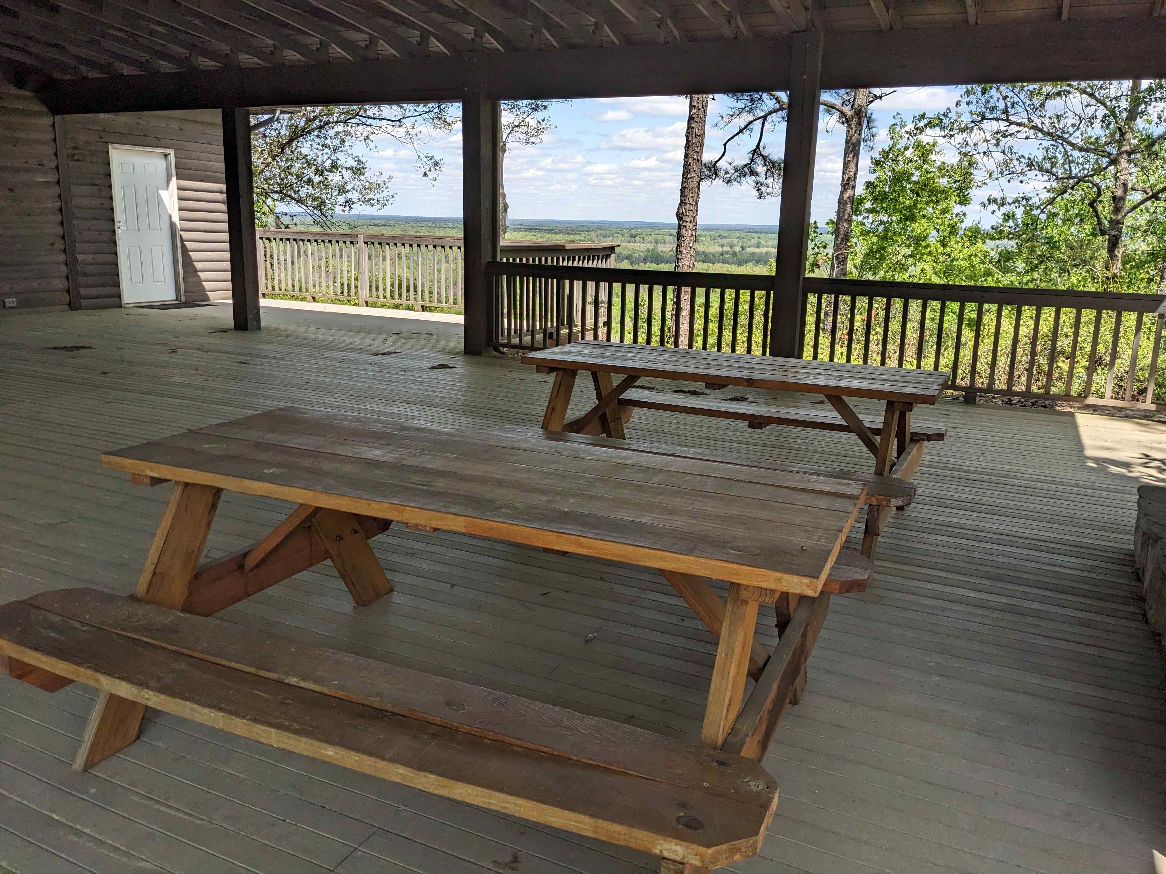
Picnic Shelter on Cook's Mountain
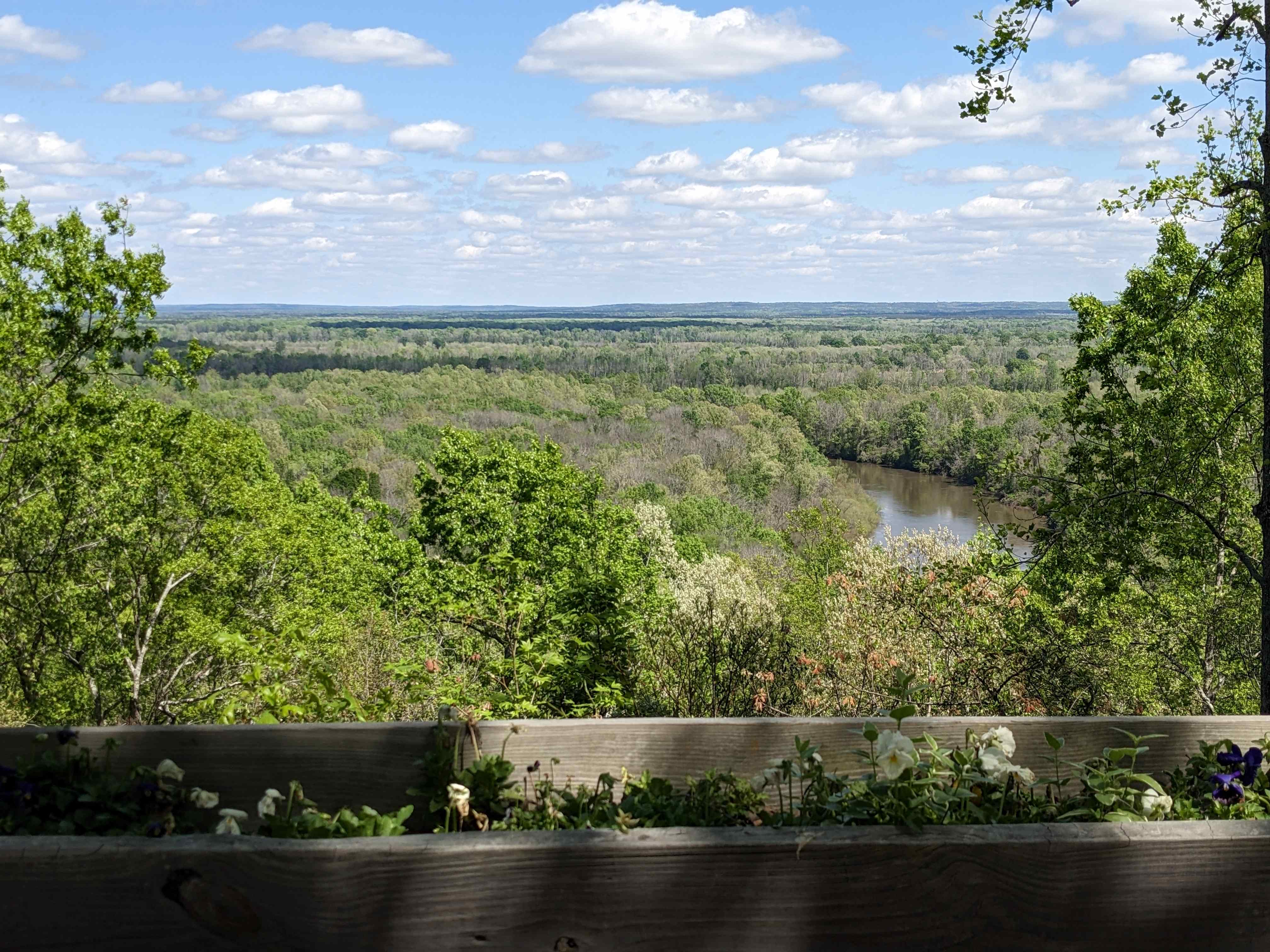
View of the Wateree River from Cook's Mountain
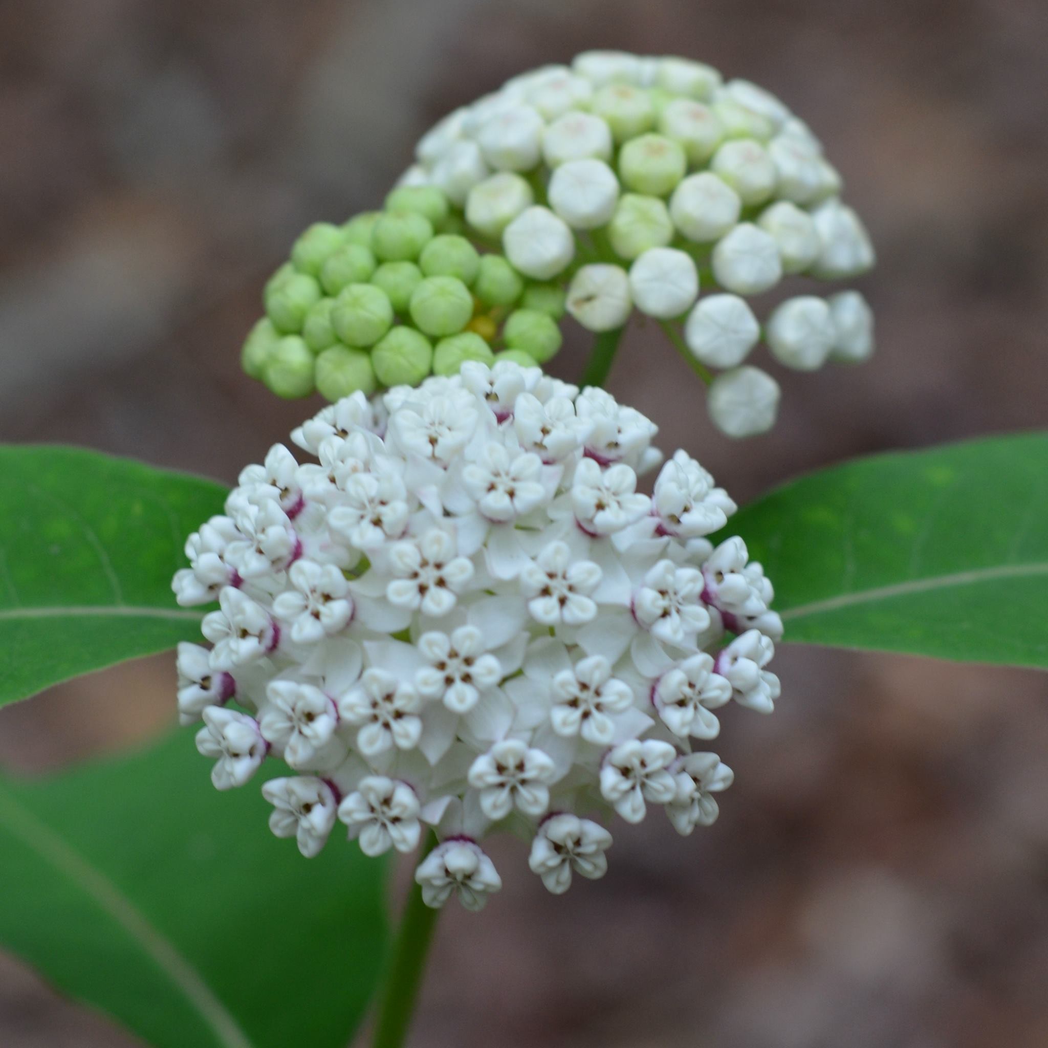
White Milkweed
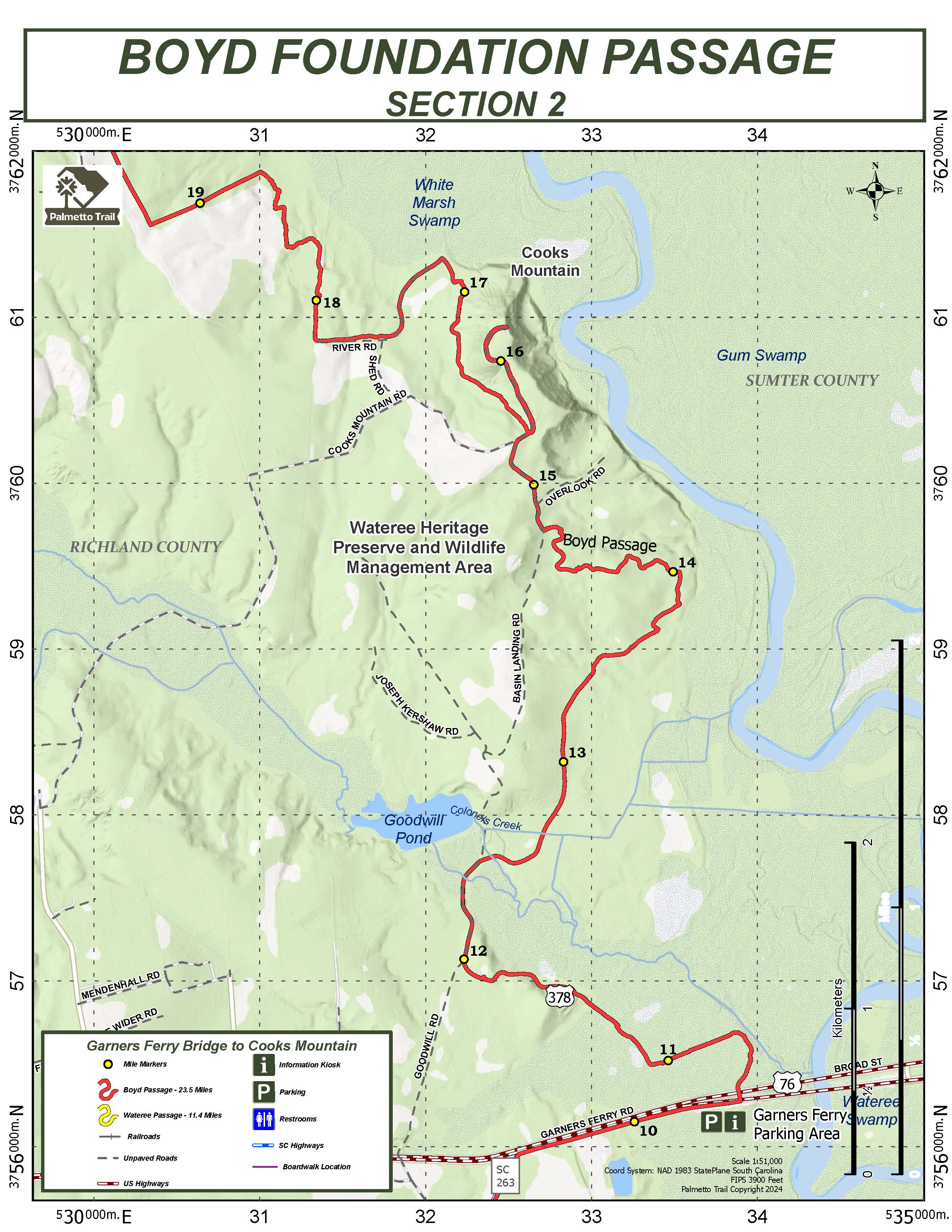
Section 2 of the Boyd Passage of the Palmetto Trail
Level: Moderate
Recommended Items: Water, snack, sun protection
Cancellation Policy: Steady rain cancels